
In order to show you the next generation visual effect of MSFS, new PBR textures and light coding are embedded into our scenery.
Buildings, vehicles, walls, airport signs and ground markings are custom made for each airport, brings you unique perspective and detail of the scenery.
With the assistance of local airline pilot, MSFS default instrument procedures are re-writed to be fully compatible with latest AIP contents.
Complete LODs built-in models to balance both details and performance.
All free mods are download through flightsim.to and only from flightsim.to as the designated platform, you can also follow to get notified when update is available on that platform.
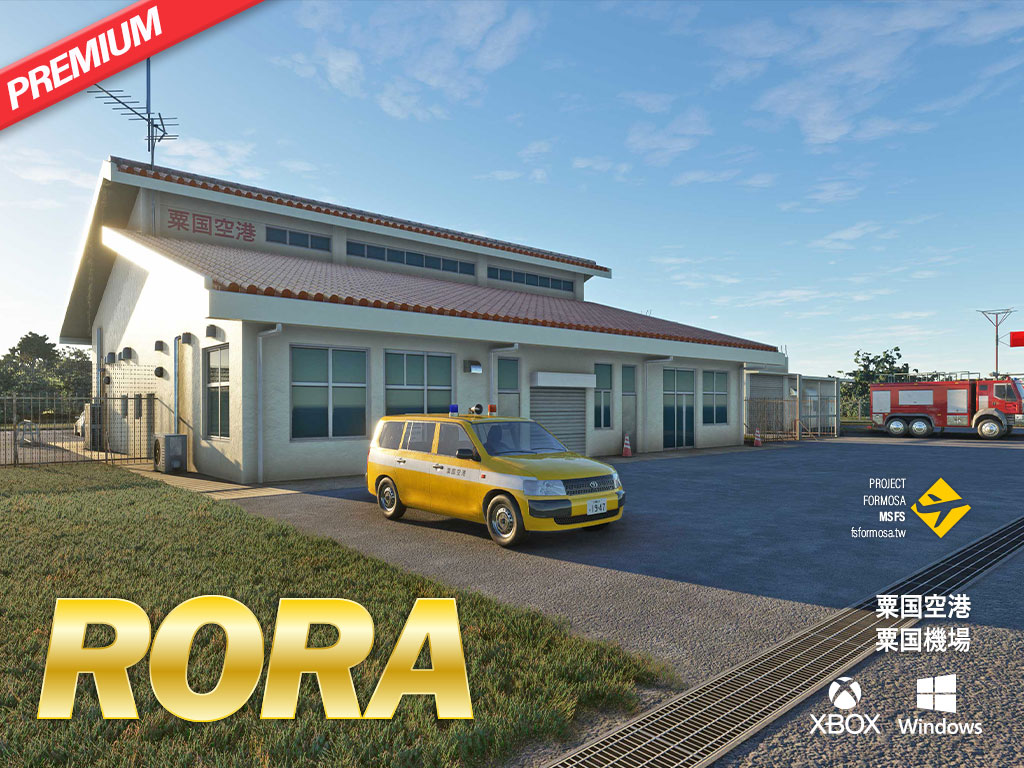
Aguni Airport (IATA: AGJ; ICAO: RORA) is located on Aguni Island, about 60 kilometers northwest of Naha City, Okinawa. The scenic rugged volcanic landscape and thousands of magnificent fish schooling during spring and summer time make this island a popular choice for advanced divers.
Aguni Airport has an 800m (2620ft) long runway. The new terminal was completed in year 2018. Currently, First Flying (ICAO: DAK) operates DHC-600 flights to and from Naha Airport on a regular basis. Excel Air Service provides helicopter charter services to and from Naha. The Coast Guard also utlizes this airport to perform emergency rescue missions.
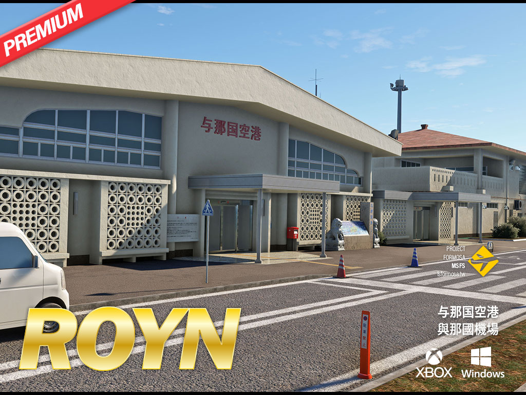
Yonaguni Airport (IATA: OGN; ICAO: ROYN), sitting on Yonaguni Island among the Yaeyama archipelago of Okinawa, is the westernmost airport in Japan, as well as the airport most close to Taiwan with only 108 kilometers away. Local residents, and therefore, are not only able to see Taiwan in a good weather, also receive Taiwanese TV channels as well. The magnificent man-mad looking underwater architectural structures (aka "Yonaguni Monument") and colorful ecology make the island a well-known diving resort. Fresh sea food and Hanazake, a unique distilled liquor produced only at Yonaguni Island, also populate food lovers' table.
Yonaguni Airport consists a 6,562 ft (2,000m) long runway, and currently, Ryukyu Air Commuter (RAC) uses De Havilland Dash 8 Q400 to provide scheduled flights to link Yonaguni to Ishigaki and Naha. The Japan Coast Guard and the Self-Defense Force also utilize this airport for emergency rescue and transportation missions.
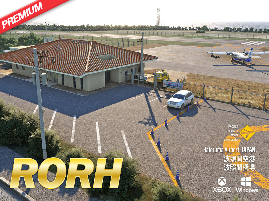
Hateruma Airport (IATA: HTR; ICAO: RORH), the southernmost airport of Japan, sites at Hateruma Island of Yaeyama archipelago. Traditional hand-made brown sugar and the best coastal scenery are well known attractions of Hateruma Island. Hateruma Airport consists a 2625ft (800m) long runway. A small terminal covered by orange color Okinawan-style roofing tiles and guarded by Shisa (guardian lion) status was completed by year 2015.
Starting from 2024, First Flying (ICAO: DAK) will provide scheduled services for the Hateruma-Ishigaki route that had been disconnecting for over 15 years by 19-seat DHC-6 Twin Otter commuter. Beside commercial airliner, The Japan Coast Guard utilizes this airport for emergency rescue missions. Helicopter tour also has been introduced lately to let tourists to experience such beautiful coral reefs scenery above the islands.

Taichung Shuinan Airport (IATA:TXG ICAO:RCLG) is a regional airport in Taiwan. It was built during the Japanese rule. It was used by the military before the 1970s. Domestic civil aviation operations began in the 1970s.
At its peak in the 1990s, domestic flights served more than one million passengers annually, with regular flights to airports across Taiwan such as Taipei, Kaohsiung, Kinmen, Penghu, Hualien, Nangan, and Hengchun. Due to urban development factors, it was moved to Ching Chuan Kang Air Base in 2004 and became the current Taichung International Airport.
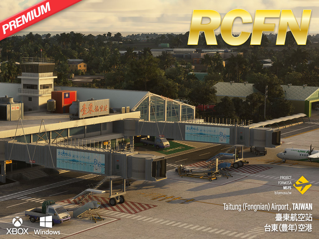
Fongnian Airport (IATA: TTT, ICAO: RCFN), also known as Taitung Airport, is an important local transportation hub that locates at the southeastern part of Taiwan, just side of the Pacific Ocean. The airport is consisting a 7,999 ft long runway to provide regular flights to Taipei by UNI Air(ICAO: UIA) and Mandarin Airlines (ICAO: MDA) ATR-72, B737, and A320, as well as Daily Air (ICAO: DAC) regular DHC6 island flight operations to Orchid Island (Lanyu Airport : RCLY) and Green Island (Lüdao Airport : RCGI). The first flight school of Taiwan, Apex Aviation is also homed at this airport, Trainers DA40 NG, DA42 NG and Tecnam P2012 are steered by young wings daily over this beautiful corner of Taiwan to pursuing their future aviation careers.
The new hangar expansion project of the National Airborne Service Corps had been completed in 2023 for stationing more UH-60 helicopters here to provide local emergency rescue operations.
In addition, this package also includes nearby scenic landmarks, bridges and dynamic travelling trains, to give reference spots and a wonderful visual flight experience.
Some assets licensed under Creative Commons Attribution.

This mod adds nurses, ambulances and stretchers to Taiwanese airports, outlying island helipads and hospital helipads. Shown in:
Some assets licensed under Creative Commons Attribution.
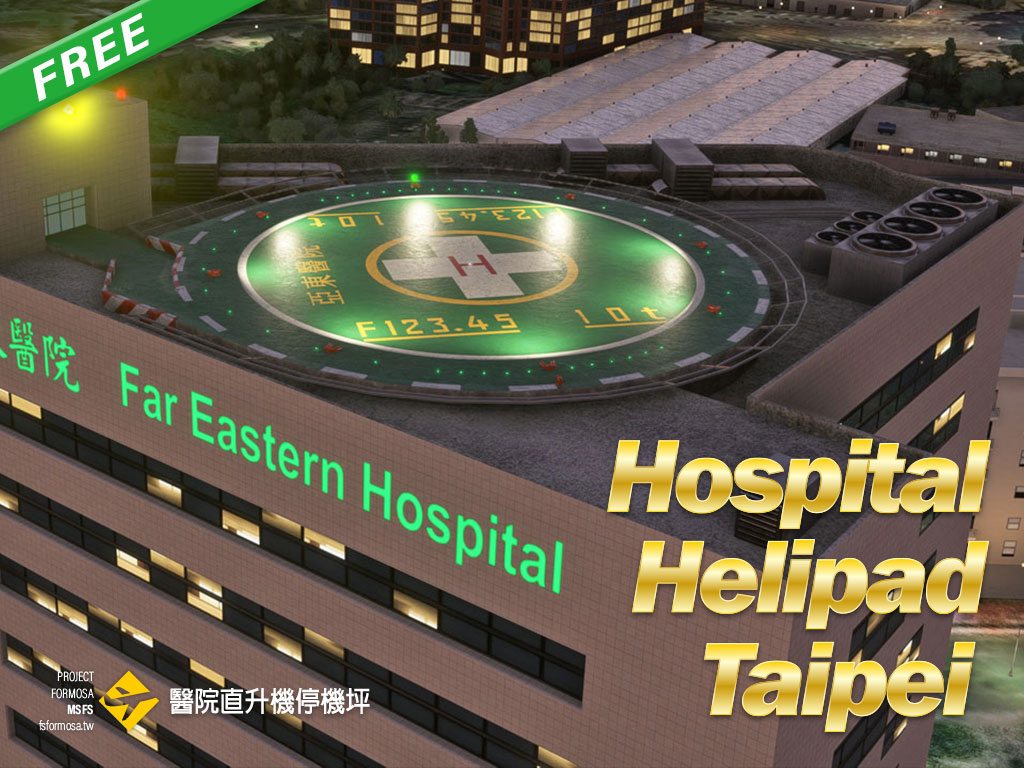
Hospital helipad in Taipei, including:
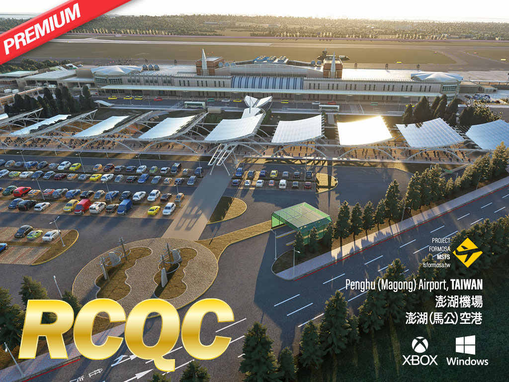
Penghu Airport (IATA: MZG; ICAO: RCQC), formerly known as "Makung Airport,", locating in the middle of the Taiwan Strait, is a joint-use military/civilian airport to serves as the main gateway to Penghu Islands. Summertime is the peak tourist season in Penghu, offering a great environment for variety of water activities. Geological wondering like basalt rock formed pillars looking cliffs, as well as vivid events such as Fireworks Festival, are also adding more attractions to the local.
During winter, the prevalent northeast monsoon presents challenges for flight operations in the real world, not mention to the FS enthusiasts.
Penghu Airport consists a runway length of 3000m (9843ft) and is operated by Uni Air (ICAO: UIA) and Mandarin Airlines (ICAO: MDA) for regular flights by ATR-72, B737, A321, and DHC6 will connect to cities in Taiwan, such as Taipei (RCSS), Taichung (RCMQ), Tainan (RCNN), Chiayi (RCKU), and Kaohsiung (RCKH). Scheduled charter service to Kinmen (RCBS) is also available. Daily Air’s (ICAO: DAC) DHC6s provide regular inter-islands flights between Penghu and Chimei island (RCCM). Emerald Pacific Airlines’ Leonardo AW169 helicopter also stations at Penghu Airport to provides essential emergency medical transportation services for the residents of remote islands.
Some assets licensed under Creative Commons Attribution.
Welcome to southern portion of beautiful Penghu archipelago. Penghu archipelago consists Penghu island and strayed 89 islands and islets in the Taiwan Strait is famous for its geological landscape, pure blue ocean, clear blue sky, soft white beaches, firework festivals, and delicious catch of seafood. Always, summer time is the high season of tourism, winter time, and however, also attracting lot of sailing lovers due to strong winter winds. This scenery pack will present Chimei airport, Wangan airport, helipads, as well as various great scenic spots site at southern section of Penghu archipelago to provide simmer a vivid tour of exploration.
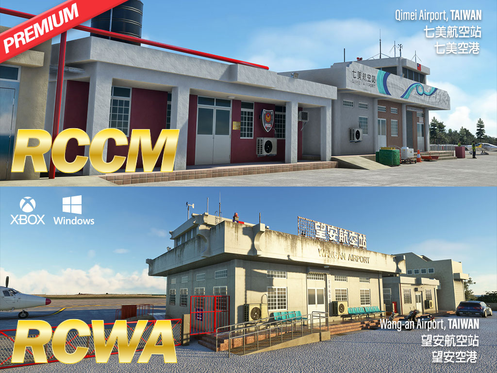
Chimei(Qimei) Airport (IATA: CMJ; ICAO: RCCM). Chimei airport serves the smallest township among Penghu archipelago. The airport consists the shortest runway (2,570 feet) in Taiwan. DHC6s of Daily Air (ICAO:DAC) are used for scheduled flights between Penghu (RCQC) and Kaohsiung (RCKH).
Wangan airport (IAT: WOT; ICAO: RCWA). Wangan island locates between Penghu island and Chimei island. Scheduled flights to Kaohsiung (RCKH) is served by Daily Air’s DHC6s.
Chimei Island
Wangan Island
Various traditional Taiwanese temples and residential houses can be found at the islands.
Some assets licensed under Creative Commons Attribution.
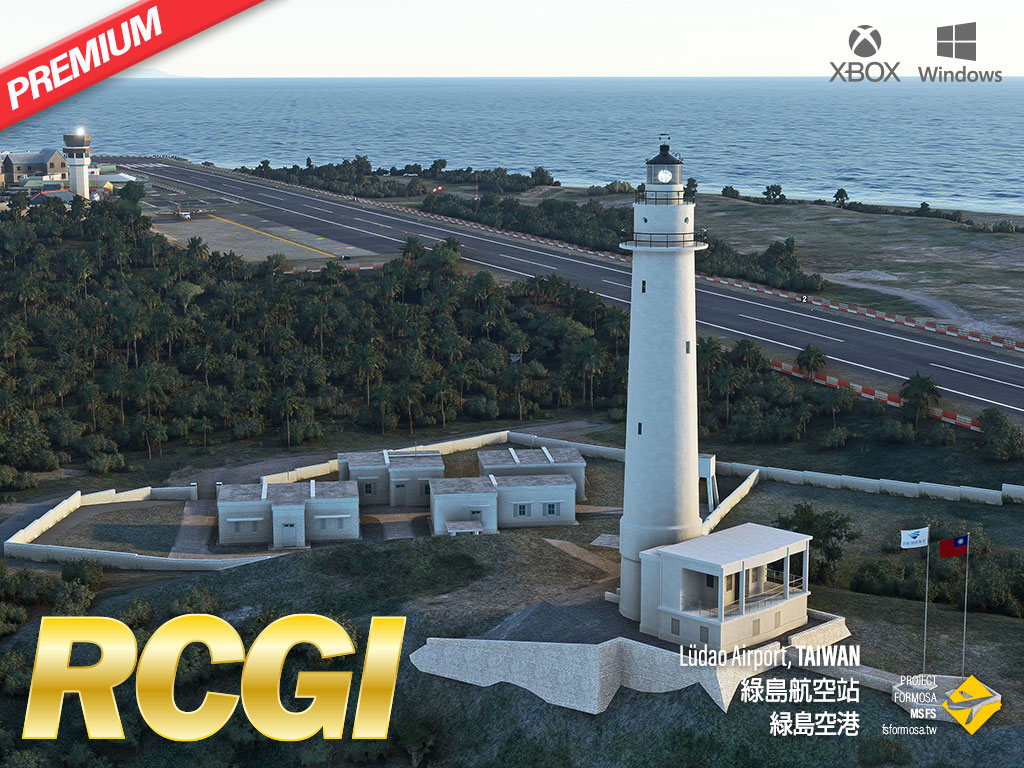
Lüdao Airport (IATA code: GNI; ICAO code: RCGI). The Green Island (also known as Ludao), formerly known as the Huoshao Island (island of fire), is a small volcanic island off the coast of Taiwan’s southeast.It was once a well-known prison for political prisoners during the martial law period in Taiwan, but now,Green Island becoming a popular tour site for its beautiful scene and hot spring.
At present, the airport’s runway is currently 917 meters (3009 feet) long. DHC-6 aircraft fly regularly to Taitung Airport (RCFN). Meanwhile, emergency medical helicopters are available to take off and land, which plays an important role in local transportation. This scenery includes the Green Island Lighthouse as a landmark, as well as the local architectural landscape near the airport.
Some assets licensed under Creative Commons Attribution.
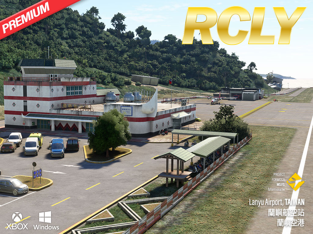
Lanyu Airport (IATA code: KYD; ICAO code: RCLY). Orchid Island, also known as Lanyu, is located off Taiwan southeast coast, which is famous for its unique Taos aboriginal culture and natural landscape. Lanyu Airport is sited at the southwest part of the island. Daily Air's (IATA: DA, ICAO: DAC) DHC-6s provide scheduled air services to Taitung Airport (RCFN). Helicopters are also able to land at this airport for emergency medical service, which especially playing an important role for local community. Regular flights, and however, are often affected, and even canceled, due to such unexpected weather factors as typhoon.
Lanyu Airport is characterized by its Taos' Tatala boat shape terminal . Beside presenting such unique airport buildings and surrounding, this scenery includes several other local landmarks such as Lanyu Lighthouse, harbor, and various local architectural landscape near the airport for providing a wonderful VFR experience in the MSFS.
Some assets licensed under Creative Commons Attribution.
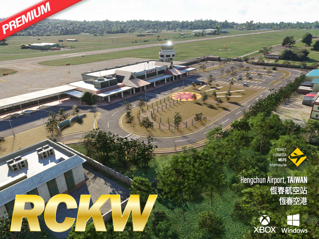
Hengchun Airport (IATA code: HCN; ICAO code: RCKW) is the southernmost and smallest airport on the island of Taiwan, with a 5,578-foot runway and a helicopter military base attached. The airport is adjacent to Kenting National Park, and you can enjoy the beautiful scenery of the south coast flying over here. There is no scheduled flights since 2015 due to factors such as the downhill wind. The scenery also includes two landmarks: the highest point in Kenting, a huge rock on the grassland - Dashijianshan, and the southernmost lighthouse on Taiwan's main island - Eluanbi Lighthouse.
Part of the picture source is Air Navigation and Weather Services, CAA, MOTC.
Some assets licensed under Creative Commons Attribution.
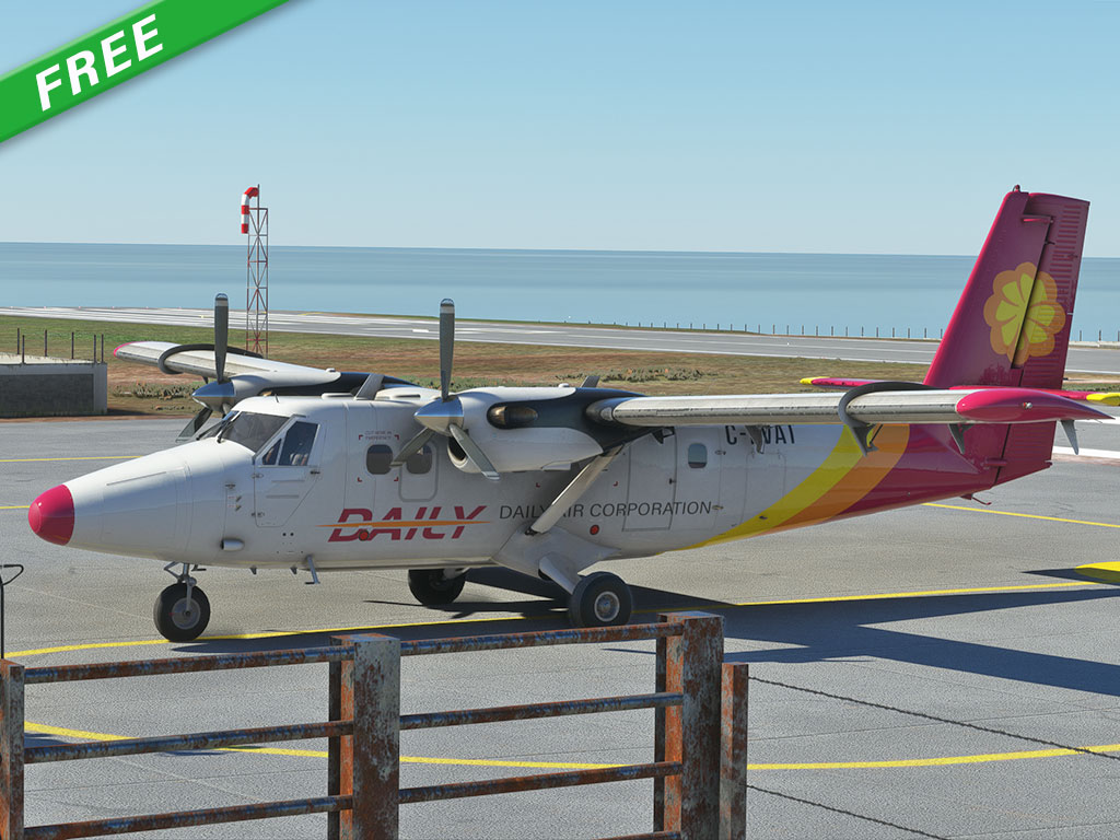
Daily Air Corporation is a domestic carrier from Taiwan. It operates scheduled passenger services to offshore islands from Taiwan, including Penghu(RCQC, RCCM, RCWA), Taitung(RCFN), Green Island(RCGI) and Orchid Island(RCLY) as well as helicopter contract services and charters. Most of the airports feature very short runway (less than 3000x100ft scale). Daily’s twotter 400 series joined service from 2016 to replace obsolete DO-228 for safety reason. This livery for Daily Air is based on Aerosoft DHC-6-300. With downloading the FS Formosa airport packages you can enjoy the challenging flights that Daily Air takes everyday.
Unzip the scenery folder and move it inside the Community folder.
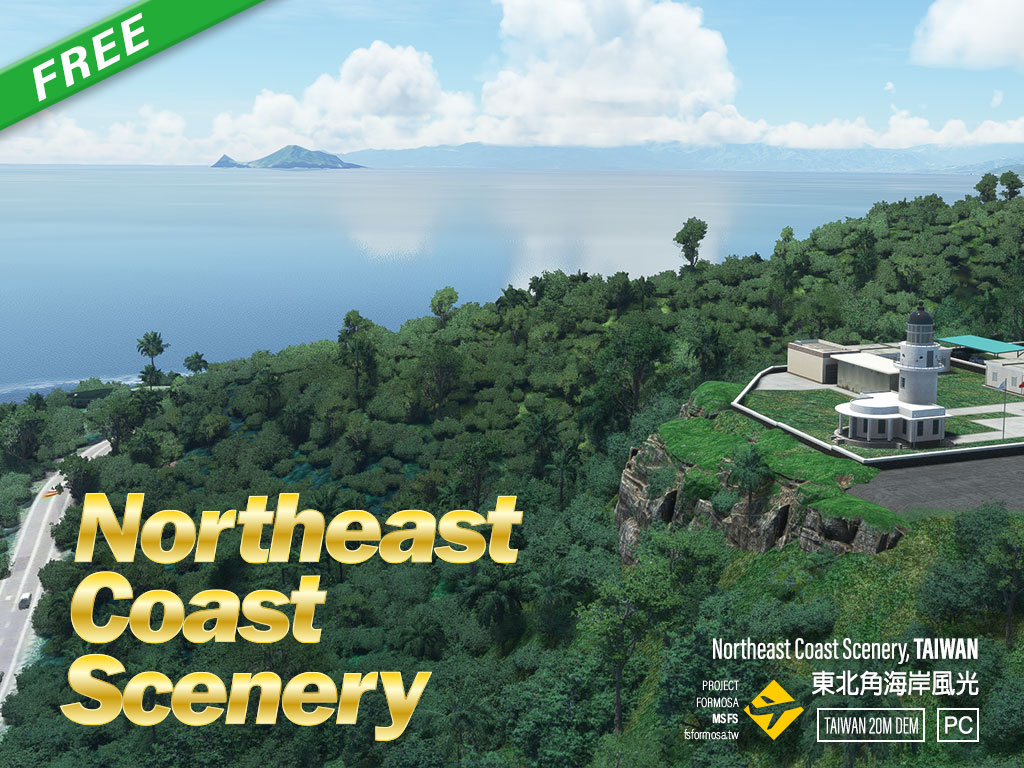
There are many scenic spots locate on northeast coast of Taiwan, which is pretty close to Taipei City and attracts lots of tourists every year. Three are so many special natural resources like scenic rocks, superb landscapes, beautiful trails, etc., deserved a look. Lighthouses, museum, temples, and ocean activities are quite popular as well.
Some assets licensed under Creative Commons Attribution by Taiwan Digital Asset Library.
Unzip the scenery folder and move it inside the Community folder.
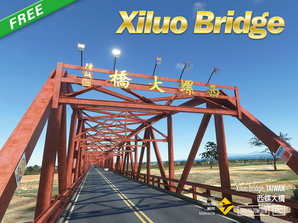
Xiluo Bridge is a beautiful red steel bridge with length of almost 2km crossing Zhoushui River in Taiwan. Xiluo Bridge's construction began in 1937 under Japanese rule but came to a halt after the attack on Pearl Harbor as the allotted steel was needed for the war effort. In 1952 the bridge was completed under the Taiwan government with American steel and financial aid. It was once the second longest bridge in the world, when it was finished, following Golden Gate Bridge at that time. Now it’s quite a famous scenic spot that many people visit here to see this historic bridge.
Some assets licensed under Creative Commons Attribution by Taiwan Digital Asset Library.
Unzip the scenery folder and move it inside the Community folder.
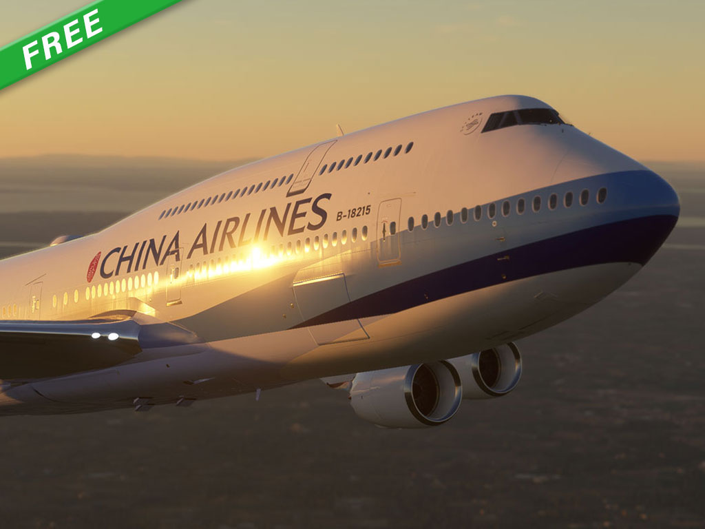
A repaint of China Airlines 747 by utilizing decal method and 8k texture. Mirror issue is solved as well.
Unzip the scenery folder and move it inside the Community folder.
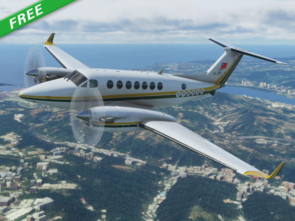
National Airborne Service Corps(NASC) , is a Taiwan government agency responsible for civil air emergency services. This beechcraft is used for aerial photos, aerial patrol and land damage survey. The repaint provides 4k texture which brings you ultra level of detail.
Unzip the scenery folder and move it inside the Community folder.
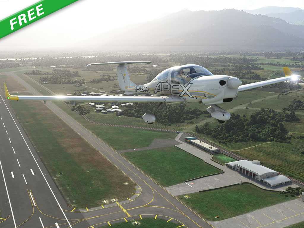
Apex is the first flight training organization in Taiwan founded in 2014,There are six Diamond DA40s in their fleet. The liveries provides you a 4k quality repaint.
Unzip the scenery folder and move it inside the Community folder.
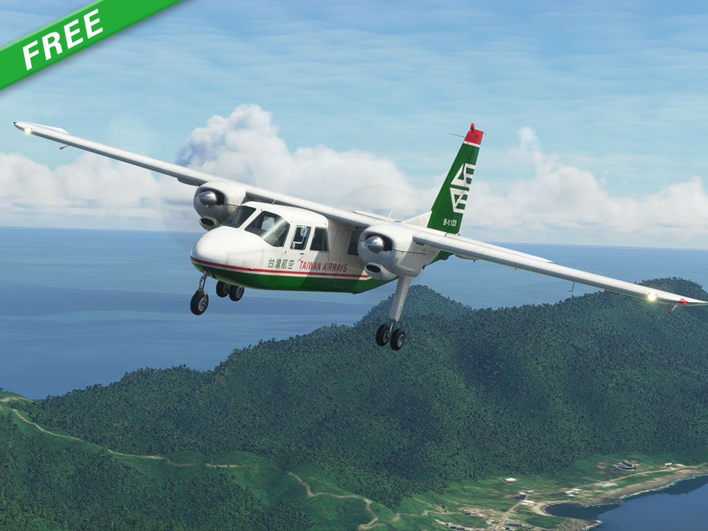
Taiwan Airways was known as Taiwan Airlines, established in 1966. In 1998, Taiwan Airways was merged with other airlines to become Uni Air. The liveries provides you a 4k quality repaint represents the ancient airlines from Taiwan.
Unzip the scenery folder and move it inside the Community folder.
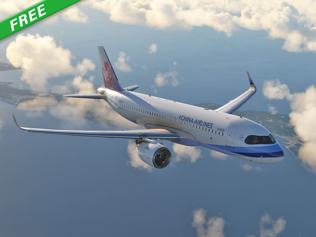
China Airlines is the largest airline in Taiwan. They are going to operate A320neo from 2021Q4. We provide you a 8k high quality repaint to have a first look of this whole new liveries.
Unzip the scenery folder and move it inside the Community folder.
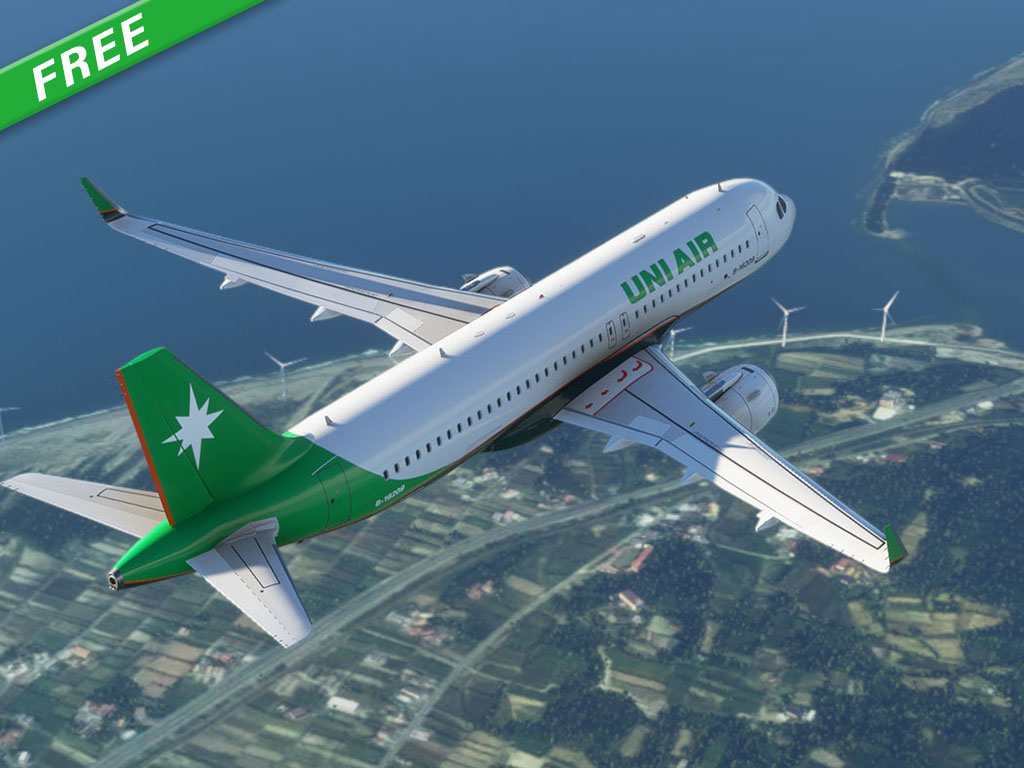
UNI AIR is a Taiwan based airline operates under EVA AIR Corporation. They transports most of the domestic routes and few regional routes. Only 2 A320 are painted with UNI AIR scheme. The 8k high quality repaint is provided with this package.
Unzip the scenery folder and move it inside the Community folder.
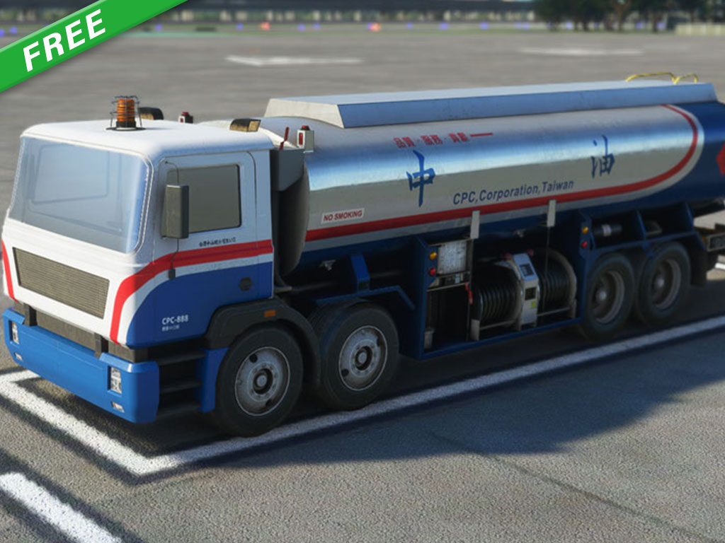
CPC Corporation is the major fossil vendor in Taiwan. Their fuel trucks are quite common in all Taiwan airports.
Unzip the scenery folder and move it inside the Community folder.